Regions and Tracks


How about spending one weekend in Noth Agrafa, the Thessaly part of Agrafa region?
Our objective is to go through the Portaikos River and Gropa stream canyons. A suitable base to stay the night before could be a small hotel in Kalyvia Pezoulas on the banks of Lake Plastira (ref. hotel recommendations in the attached map). However, since the proposed track is a complete 360 degrees round, there is a number of other lodging proposals (ref. map) in selected Agrafa villages. The track description below, assumes Kalyvia Pezoulas, as the starting point.
A note of warning; do not try this track before mid May, since there are a couple locations crossing mountains, with an altitude exceeding the 1,700m. Hence, it is possible that residual snow in shaded curves of the dirt road, may block you changing dramatically your weekend plans.
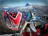
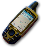
We depart early (08:00) in the morning from our hotel in Kalyvia Pezoulas. Better have our GPS mounted on the handlebar of our bike, with the track and waypoints loaded. Should you have no power cable connected, ensure you have a couple of spare batteries with you. Last but not least, in spite of having your electronic map companion, also get with you an A4 page with the (printed) map of the track region.
We start our ascend to Pezoula and Fylakti. After Fylakti we leave the asphalt road, entering the Agrafa mountain, making our way in–between Voutsikaki (south) and Kazarma (north) peaks, a kind of "saddle point". Our aim is the famous Argithea village.
After passing the saddle point, we start our descent, meeting again the asphalt road and the waypoint "PEZA2ARGITH". Around there we enter again the dirt road ascending to 1,700m alt. going through peak driving at the top of the mountain sierra (view here). Next control location is the "PEZB2ARGITH", namely "Ovria". From there we turn north, and in the next 3.6km we reach the main asphalt road connecting Argithea with Mouzaki. Turning northwest we easily drive to Argithea village.
From Argithea we take the main asphalt road southwest. Down on our left hand flows the Platanias stream. After approx. 6.5km we reach a junction. This is the village "Agorasia", and the waypoint "J2ARHITHEA". View here the canyon from Argithea up to this junction location. From there we turn northwest, having a stream flowing on our right hand and within 3.6km of asphalt road we reach the Anthiro village (aka Boukovitsa). (view here this part of the track, as it is looking from Anthiro viewpoint).
We have almost completed one third of our round track (i.e. 0400 to 0800 clockwise). We depart from Anthiro, following the dirt road through the canyon, ascending to village Lagadi in 2.5km proximity. From Lagadi, in 3km of ascending dirt road, we will arrive in Metamorfosi village. Now we are on 1000 of our round track. It is not a bad idea to have a brief stopover before resume our ride towards Paliokaria and Pili. Let’s have a look back, from where we came from (view here).
We depart from Metamorfosi village, prepared to ascend up to 1440m altitude, at a saddle point [waypoint "SADDLPT"] , at location "Poulimenos". From this high point we start our descent for 10km approx. until we reach the "Ano Paliokaria" village, where asphalt road starts again. From this point we will go next to "Gropas" stream (on out right /south side). In 1km we will get into Mesi Paliokaria (view here the canyon), and then in 1.7km in Kato Paliokaria. In the way forward we will meet the impressive falls with an arc–shaped old bridge and then is formed the famous and beautiful Portaikos River. Finally we go through Ag.Konstantinos village to Ag.Vissarionas old bridge and from there to Pili township.
At Pili we are on 1200 of our round track, and this is virtually the end of our north Agrafa ride. Now we follow the main asphalt road to Mouzaki and from there we drive south to our base via Kriopigi, Anthochori, Kerasia and Kryoneri.
Note:
Should you prefer to avoid the challenging segment, in the very beginning, from Fylakti to Argithea, then here is an alternative and risk–free route. Departing from our base (Kalyvia Pezoulas ) in the morning, drive north towards Mouzaki. Just 3km before Mouzaki, you will see a junction with the sign that the road on your left (west) is driving to Argithea. This is the main asphalt road (Mouzaki–Argithea). However you will miss a famous part of Agrafa, i.e. Voutsikaki and Kazarma mountains.
We hope you will be back before the sunset, loaded with deep satisfaction of another successful enduro track, and a lot of pictures in your camera.
Should you used your GPS to record your track during the day, then we would be delighted to share it with us (use our feedback page, attaching your track file).