Marathon lake to Sesi on Evoikos gulf
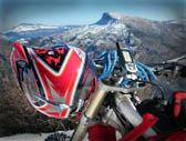
Countryside enduro, just 25km outside Athens center
Introduction
Let’s go through a quite interesting enduro track which is very close to Athens, combines mountain and sea, and offers both slow hard tracks enduro, as well as flat fast track segments for those of you that need to unleash the 50+ horsepower, making the difference from the crowd.
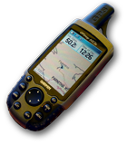
The track is a complete round circle over north east Attica region. A suitable starting/meeting point is the one suggested in our attached GPS files (
waypoint [SP01]) next to Afidnae national road toll station.
Track description
Let’s go through the proposed route, by commenting the segments of particular interest (
re: waypoints, as shown in attached "kml" and "gpx" files):
- SA04-07:
This is a very nice location near the banks of Marathon lake, where a rich water stream from Parnitha Mt. flows into the lake. (re: photos). Then follows a typical enduro track with steep slope, narrow pathways into dense vegetation.
- SA18:
A viewpoint on the street, above a water stream which is flowing into Marathon lake, overlooking a major part of the lake, with Penteli Mt. in the background.
- SA23-24:
A short but very nice path downhill, leading to Moni Panagias near Varnavas village.
- SA31-32:
A straight downhill, quite rocky, aiming to train you in driving faster in such challenging situations (don’t try driving fast, unless you feel confident with it).
- SA30-40:
This is a 9km downhill, getting you from 570m alt. to the sea level. In certain points the max. slope is reaching 21%. From time to time the free view down to Evoikos gulf is rewarding.
- SA42-48:
This is what few of you were expecting all this time. A long, flat and fast dirt (race) track, to get your adrenaline flow free. It’s driving you from Ramnounta, towards the main road to Ano Souli.
- SA65-67:
Now you have a steep uphill in front of you. It’s hard, it’s rocky, doesn’t like visitors at all. Within 3km, you will find yourself 354m above sea level; occasionally the slope exceeds 22%. Excellent training opportunity. It is the Skarpa mt. which lies between Marathon village, Dionysos and Marathon lake.
- SA68-76:
From hill top, down to Marathon lake main road, with a nice view of the lake.
That was all, the interesting part. Now drive carefully on the main road, to Ag.Stefanos and from there towards Kapandriti, back to your starting point (in case that you left there your trailer).
Should you liked it, just
load your GPS and go!