Regions and Tracks
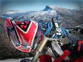


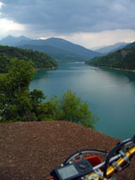
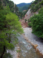
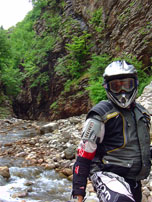
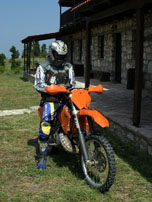
Should you have no Agrafa experience, get it as soon as possible. Agrafa is a quite expanded mountainous area, therefore it is recommended to select your own itinerary, either south, north, east or west.
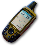
We had a two days enduro event, crossing Agrafiotis river. By that we mean starting from Evritania, Lake Kremaston and ending at Belokomitis in Plastira Lake. The attached GPS track contains also a couple of alternative, optional, tracks. You may use the primary track (TRACK01) northbound, and then the alternative (east Agrafa) track, on your way back, southbound.
Our own experience was quite wet! No, it is not true; it was absolutely wet, to the bones!
It was a typical -early June- sunshine day. Upon entering Agrafiotis narrows (TRACK01), the first rain drops made their appearance on our visor. Gradually the sky was getting darker, and the rain was becoming really heavy. Near 15:00 the noise of the water drops on the helmet was so strong, like small stones dropping from the sky. Soon we realized that it was thick hail! The temperature dropped down close to 10°C, and the only way to keep warm was to drive fast; really fast. Actually one chase the other, like if it was about earning some more seconds in an enduro race.
Eventually we reached the milestone point NT05, the small Ag.Nikolaos church, in the saddle between Borlero and Plaka heights, in East Agrafa. From there, you can engage your bike’s auto pilot, which will get the downhill to Plastira Lake, near Belokomitis. We reached that point at sunset, when it was starting to get dark.
On the way back, you may use TRACK02, which will be longer, although will allow you to meet local people, passing through famous Agrafa villages, as Agrafa, Marathos and Chrysso.
