Regions and Tracks


The mountain named as such after Taygete, daughter of Atlas, while the highest peak called Taletos (locals call it Elijah).
Taygetos runs north to south, between Messinia and Laconia prefectures. It is one of the largest and most beautiful mountains in Greece. North starts from the plateau of Megalopolis and ends south in Cape Tenaro, with overall length of 110 km. On the broader point that is approximately in the middle, its width is 29 km. The area of this surface is 2.544 million acres. Along with Parnon are the oldest parts of the Peloponnese peninsula.
Two canyons are separating Taygetos, one of the Great Lagada, which separates the North from Grand Central Taygetos in Tripi village and the second, named Sangias, is in the region of Areopolis to Kotronas that separates the Central from South Taygetos.
In the northern Taygetos there are a few minor peaks, as Xirovouni (1.852m.), Neraidovrachos (1.784m.), Lepenou (1.733m.) etc.
The high turnover of habitat leads to the existence of more than 600 species of plants, over 120 Greek endemic plants, of which 32 exclusively in Taygetos, while it is reach in herbs and aromatic plants (oregano mint, thyme, tea, lavender).
The slopes of Taygetus are heavily forested, primarily with Greek fir (Abies cephallonica) and black pine (pinus nigra). Devastating fires in 2005 and 2007 consumed much of the forests on the central west slopes, and only about half remain.
Have been observed 85 species of birds, 19 mammals, 33 reptiles and amphibians.
Our base was in Kastori village, which is loated approximately in the middle of the distance between Tripolis and Sparti, on the west side of the valley, right below Taygetos mountain.
Aiming to enjoy most of the north part of Taygetos mountain, we departed from Kastori village and drove north to Loganikos at 815m alt., from there we entered the uphill road into the Taygetos mountain. Our enduro experience commenced at this point, since the dirt road outside the village had disappeared due to works installing an underground drinking water pipe feeding the village.
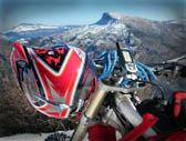
Then [TG913 to TG904] we followed the forest dirt road running up on the mountain up to approx. 1,450m alt, where we were on the mountain ridge. Then 1km after [TG903], 37km after our departure, we changed sides of the mountain, dropping from the east on the west side. Around this area the mountain was covered with tall black pine trees (see photo).
Up to the 46th km we were riding in a straight line on the ridge of the mountain, above the 1,400m alt. hen (after [TG900C]) we started our downhill, eventually meeting the main road linking Kalamata to Sparti. At this point it is offered a stopover to the Tourists Canteen, which is exactly on the exit of the dirt road to the main street. This is the end of the enduro track [TRACK01].
Should you wish to run a full circle, returning back to Kastori, then it is suggested to follow [TRACK02], with a unique opportunity to visit the famous Mystras, fortified town in Morea (the medieval Peloponnese) on Central Taygetos mt., near ancient Sparta.