Regions and Tracks


Our accommodation was in the Panourgias village. There's an old small school that has been converted to a hostel, supported by European Community funding. The location, the operator name and telephones are all embedded in the kml file link in the sidebar of this web page.
From Panourgias follow the asphalt roads and reach the main road linking Pavliani to Lidoriki. Here is the crossroad to Mavrolithari and west from there you reach Kastriotisa village. At this point the asphalt ends. Then follow the street, to Daphne. The road is under construction, almost ready for asphalt. At an intersection, just before Daphne, turn east (re: attached GPS tracks). From this point onwards the road is wooded and beautiful. Passes beneath dense stands of trees, with lots of water streams crossing your path.
We arrive in Neochori, which is a small but tidy village. Around the central square is the church, the fountain of the village, cafe and guesthouse. Here again, the "Xenonas" (re: guesthouse) is hosted in the old village school.
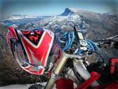
Then the road continues to climb up in Iti mt. Passing the 1800m altitude, the vegetation changes and the landscape doesn’t have any trees at all. Although when we were there was mid June, with a little imagination you could visualize the landscape covered with thick snow. An immense white surface with smooth curves. On our right (south) was the highest peak of the Iti, the Pirgos (transl. Tower).
Then the road descends lower and fir forest starts again. We pass the famous "Vrisi tou Kalogerou" (transl. Fountain of Monk) (wpt: rd29) which is running water all year. Soon after we are arriving at the center of the National Park of Iti. The crossroad extends to three directions: South to Pavliani, west to Neochori and north to Ipati.
Getting our orientation towards south, we begin to descend to the main road linking Pavliani to Lidoriki. The ride is amazing. Quick paths, short swift uphill and downhill paths rotated continuously. Makes you think this route will never end. Eventually, behind a downward shift, the main asphalt road is unveiled. Another Enduro track is over. Impressions in our mind, photos in the camera and much oxygen to our lungs is what inherited from the last 3 hours.