Regions and Tracks


Iti’s prior name was "Katavothra". With an altitude of 2.152m. is one of the most beautiful Greek mountains with magnificent fir. The bare parts are forming beautiful meadows full of wildflowers.
Core Iti National Park is the part of the mountain which is higher than 1,500 m altitude. In the south is mount Giona, in east Kallidromo and west Vardousia. In the north, the slopes are steep, leading down to Ipati and Sperchios valley. The highest peak of the mountain is Pirgos at 2.152m. Other peaks forming Iti Mountain are: Alykaina 2.058m., Pyra and Fterotos.
The Iti Mountain is rich in water. There are three rivers originating from Iti highlands:
Iti is a mountain with great terrain. All sides except the south are steep. Deep ravines and rocky terrain make the mountain almost inaccessible. However when it comes to the south part, it welcomes you with easy and beautiful trails and forest roads. Especially when you climb above 1,800 m altitude, then suddenly all calm down. Plateaus, meadows and rounded peaks are stretching across the central band of the mountain.
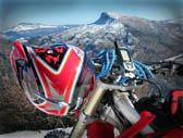
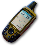
Stay at Ano Pavliani, and early in the morning ride your bike, mount your GPS loaded with our tracks and waypoints and go for an unforgettable enduro experience.
We propose one track (TRACK01), quite long, making a full circle around Iti, as well as a couple of interesting extensions as optional alternatives; especially in case you plan to spend a whole weekend.
Should you prefer to have a shorter ride, then you may use the shortcut of track ALT02, probably in conjunction with track ALT04. Thus you will limit your domain within the southern part of Iti.
Last but not least, track ALT03 which is only 10lm long, will offer you a unique opportunity to reach the top of the steep rocky northeast side of Iti, and enjoy a magnificent view over Maliakos gulf and beyond.
And now a word of warning before you jump on your bike:
The area around waypoints IC20A to IC27 (TRACK01), and IC41 to IC45 (ALT04), is very difficult to go straight through without the aim of a GPS loaded with the proper route data. The dense forest with short visibility and the large number of paths and forest roads, is transforming this area in a maze that you can easily spend long time before finding your way out.
Go and discover the real Iti Mountain…