Regions and Tracks


Acheloos river, a.k.a. Aspropotamos, is formed by numerous smaller streams (Aspro, Valia Saka, Kopraou, etc.) joining their waters. Begins at about 2,000 metres elevation on the eastern slope of Peristeri (a.k.a. Lakmos) mountain in the Pindos range, near the village Milea in the Trikala Prefecture. One of its first tributaries is the Aspro river, meaning the white river.
The river flows generally southwards, and forms part of the boundary between the prefectures of Arta and Trikala, which is also the boundary between Epirus and Thessaly. Further downstream, it forms the boundary of Arta and Karditsa Prefecture, and further of Aetolia–Acarnania and Eurytania. The river runs into the Kremasta reservoir, which is also fed by the rivers Agrafiotis and Megdovas.
On exiting the Kremasta reservoir, the river flows southwest into Aetolia–Acarnania, feeding the Kastraki reservoir, west of the Panaitoliko range. 10 to 15 kilometres downstream from this lake, it flows into the Stratos reservoir. Further downstream, it runs west of Agrinio and into swamplands and forests. It is crossed by a 2 kilometres long bridge of GR–5/E55 (Ioannina – Antirio). It finally empties into the Ionian Sea, west of Messolongi. The river offers a number of wonderful canyons.
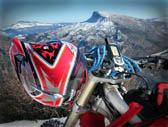
Although this is a two days trip, however it will be need to get in position the evening before. Typically a full weekend will provide you all th time you need to relax and enjoy the unique nature of Central Greece. Let’s plan it together:
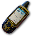
We spend a few hours on Friday evening, to reach the starting location of our trip. This is Anatoliki (East) Fragista. About 45km next to Karpenisi. Recommended small hotel to stay for the first night can be found in the attached map (just click the icon with the map on the left, to show the tracks, as well as the proposed hotels and the gasoline refill opportunities along the way).
The Eastern Fragista is a sophisticated village with excellent scenery and natural beauty. It attracts visitors year–round. At the central square with cafes and restaurants you can enjoy the tranquility of village green trying the local raki and taste traditional dishes.
On the opposite side of the hill we find the West Fragista, one of the liveliest villages in the county with a significant tourism infrastructure.
The shores of Lake Kemaston meet the village of Episkopi. The Episkopi bridge will lead you to the other side of the lake. The village is one of those covered by the waters of the lake. It was built on a flat area on the banks of the river.
The picture of the Lake Kremaston surprises visitors accustomed to the familiar countryside landscapes. Words are inadequate to describe the charm of the lake mirrored in the waters of the imperious mountains of Southern Pindos.
We depart from Fragista, following a northwest route, towards Megalochari village. Just on the left side, after Krioneri Bridge, at Agarfiotis river, there is a chance to refill your gasoline tank. Then we reach another bidge, namely "Templas Bridge", and 3.8km afterwards we enter Vrouviana village, where there is another gasoline station.
After Vrouviana we turn north, heading for Ano Klimentini village, having the river flowing on our right side. We go through Kria Vrisi, Kastanies, and Platanos. From Ano Klimentini we have two alternatives driving to Palaiokatouno. The one is to go north, which is shorter; although road is tougher. The other, which is strongly recommended, is to go south, and run half circle clockwise, until we reach Palaiokatouno. The later is a very nice country road, with excellent view, that you will definitely enjoy.
Right after Palaiokatouno, we will meet two nice villages, the famous Vourgareli and Athamanio. Both are on the southern side of Tzoumerka mountain, belonging to Arta prefecture.
Vourgareli is one of the largest villages in the mountain area of Tzoumerka, 56 km. from Arta. It is located between two hills covered with fir trees, east the Profitis Ilias and west the Omali hill, that protect the village, as a natural breast. A village particularly favored by nature, having dominant vegetation with all kinds of green tones, affluent running waters forming two streams at the borders of the village and full of stone houses with tiled roofs, as well as a wide view to the open horizon. The most likely explanation for the name of the village is that before the area got populated, this very place was covered by a dense wood where worked a woodcutter named Vourgarelis. Thus, those coming from the neighboring villages to find wood looked for Vouglarelis. For about 30 years (1950–1980) the name of the village has been changed to Drossopigi. Georgios Papadimitriou, searcher and teacher, claimed that the first houses were built in the years 1600–1630, while the first inhabitants originated from the surrounding settlements. In 1881, after the liberation of the Arta region from the Turks, was created the Municipality of Theodoria, with Vourgareli as its seat. In 1912, upon the abolition of the municipalities, the Community of Vourgareli was instituted and then, in 1998, the village became once again the seat of the Municipality of Athamania. Vourgareli was one of the region’s larger villages, with schools, educated inhabitants, public services, and important social and intellectual life. The difficult years of the German Occupation deeply marked the village. Germans bombarded the village in May 1943 and then burned it in October of the same year, destroying the largest part of the village and killing a lot of people. The inhabitants of Vourgareli rebuilt their houses and managed to get a life. The urban pull of the ’60s devitalized this village. In the recent years, however, efforts are made with encouraging results. Vourgareli became once again a lively village with important development prospects and new activities.
Athamania can be described as the most charming village of South Pindos since it is built on the highest Tzoumerka peak, in Kakarditsa, with the altitude of 2450m. It is surrounded by three more peaks. A quiet stream divides the village in two, which the locals call the “machalades” and who communicate with a small wooden bridge that completes the typical traditional character of the village. In winter Athamania is “closed” after its residents –mostly farmers– descend to the pastures, coming back again the summer. They are gathered in the small village square; recalling their experiences from the pastures. In the fountain in the village square, and the other fountains as in Batal, in Agathaki and Vaeni, the locals entertain together conveying the local news and welcoming guests who want to know the village. They offer them coffee or raki and a brief tour, demonstrating that the famous hospitality of Athamania is real and authentic.
Then driving north towards the famous (and long pending completion of its construction) Mesochora dam. From this point onwards the road is offering absolutely unique visual experience. Don’t rush, and try to leverage on this opportunity you will have, will then end of the today’s trip.
Just 1km before the Mesochora dam, we turn left (north). From this point onwards we are in the core of the Aspropotamos region. One of the most beautiful countryside’s in Greece.
Let’s drive directly to village Polythea, where we will stay in a local small hotel (xenonas) and spend the night. The contact details of this hotel can be found in the attached map. As an alternative there is also a nice small hotel at Chaliki (a bit north, along the same route).
We depart from Polythea, prepared to go through the main villages in Aspropotamos area. This is about Kalliroi, Chaliki and Anthousa. From Chaliki there is a recommended enduro track which gets you on the top of Peristera (aka Lakmos), at Drakolimnes.
After visiting Chaliki, we get a bit backwards (south) and turn left (east) to Anthousa village, and from there the road will drive us to Metsovo and Egnatia highway. This will denote the end of our trip in Central Greece countryside. We will tight up our helmet and jacket, wear our gloves and start our descent toward Kalambaka, Trikala and Larissa (unless we have a reason to follow Egnatia highway).
Remember to get back with a lot of photographs and memories that will fuel up your creative imageneering till the next ride.